上海市思维导图 Shanghai Mind Map for Archie’s Press
与纽约地图与压印艺术家亚历山大 · 阿尔奇 · 阿尔尚博合作项目/In Collaboration with Archie’s Press凸版印刷;20 x 20 cm/letterpress print; 8 x 8 inch
2018年夏,纽约,纽约州/Summer 2018, New York, NY
北京市思维导图是我和阿尔奇的第一个合作项目。在合作完成之后,我们决定再次合作一起完成这个上海市思维导图项目。上海市是中国大陆的直辖市之一,同时也扮演着国际金融中心的角色。作为最有影响力的国际大都市之一,四衢八街的上海以华灯璀璨的摩天大楼向世人展示着它的灿若繁星。
The Beijing Mind Map was my first collaborative project with Archie. After we finished it, we decided to collaborate again to make this Shanghai Mind Map happen. Shanghai is one of the direct-controlled municipalities in mainland China, and it is well-known for acting as a global financial center. Being one of the most monumental cities all over the world, Shanghai is extremely fancy with hundreds of thousands of skyscrapers.


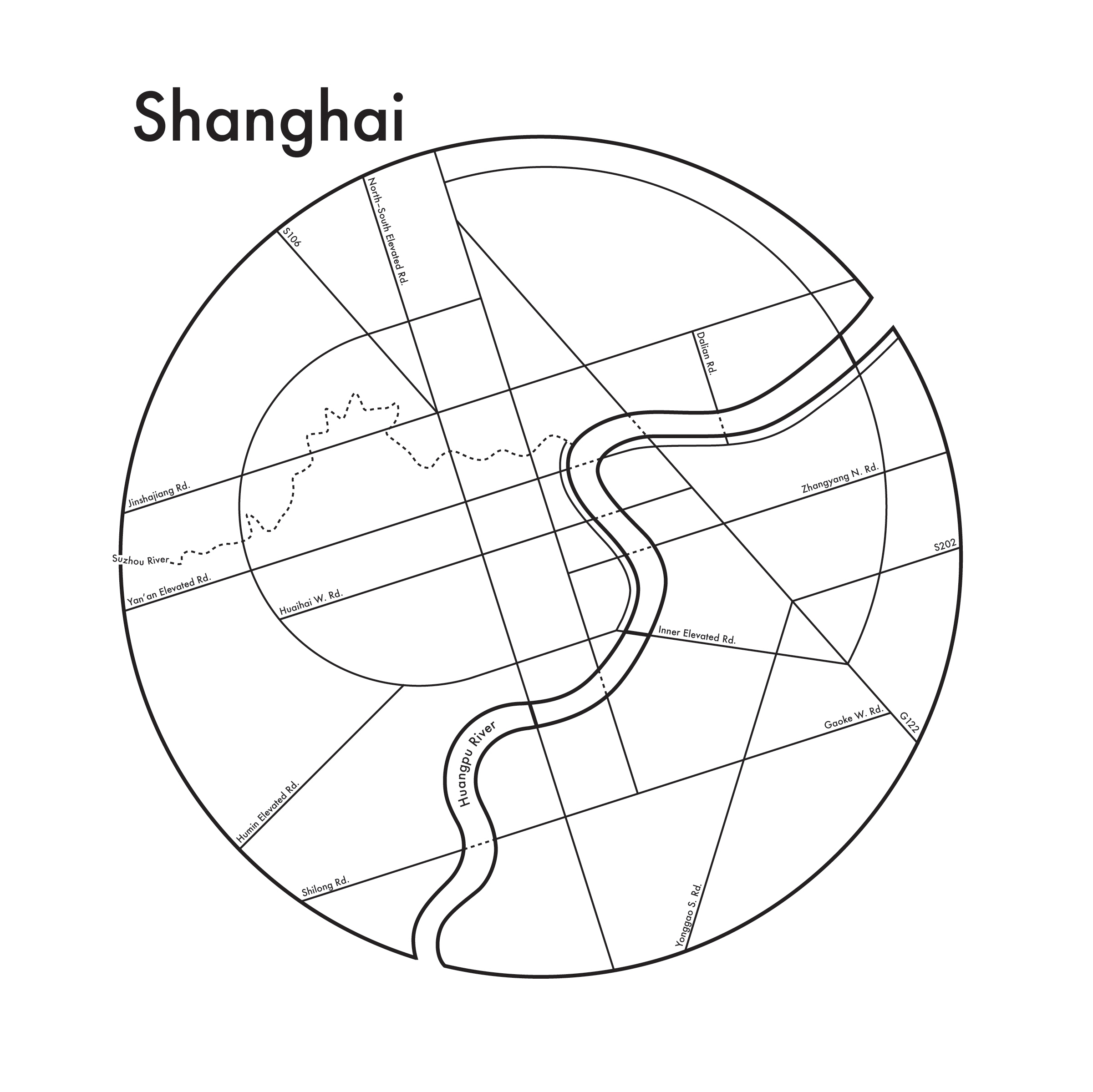
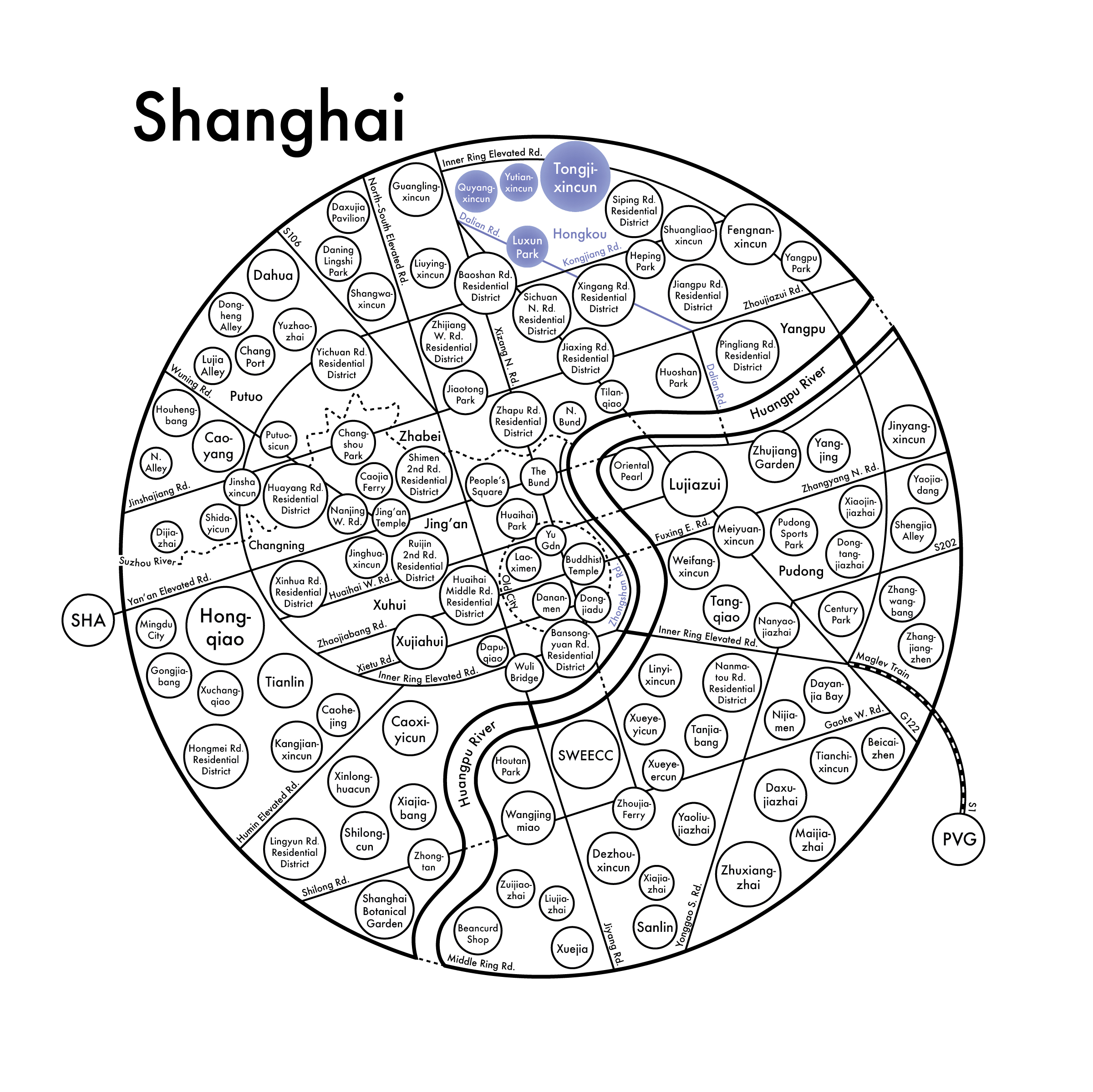
我从观察上海市地图并试图寻找出我们的大范围开始进行设计。因为上海市拥有世界上面积最大的城区。我决定把重点放在由中环高架圈出的中心城区上。此外,我用城区的主要道路构架了地图设计的网格系统。
由于中环高架外形具有较强的几何特征,于是我将地图设计整理为被蜿蜒的黄浦江分割开的正圆形,且黄浦江的曲率与宽度都使用了实际的形状。在此基础上,我尝试了将内环高架设计为同心圆但最终我放弃了该方案。因为它与真实的地理关系相去甚远。在做了地铁相关调研后,对上海来说,地铁并不具有重大意义,于是我决定不在地图设计中纳入该元素。相反,自然地理对上海更具代表意义。因此我保留了苏州河(即长江支流黄浦江支流吴淞江上海段俗称)的真实形状。
在网格的设计上我试验了三种方案:方案一为真实的几何归纳,但效果过于琐碎;方案二为贴合正圆形外形的曲线设计,但纵观阿尔奇设计过的所有地图,道路网格均由直线构架,因此该方案也被放弃;方案三为极简主义的几何设计,对实际的道路网有所归纳但不失呼应并能够与其它地图形成系列。在与阿尔奇交流后,我们一致同意在此基础上进行细化设计。【2018年05月15日】
I started from looking at the map of Shanghai to try to figure out what our “big picture” will be. Since Shanghai is the city that has the largest urban area, I decided to foucus more on its center part, which is defined by its “Middle Ring Rd.” Besides the area setting, I also use its main roads and streets to help build the grid system of the map design.
Because of the geometric feature of the Middle Ring Rd., I decided to get started with a perfect circle being divided by the sinuous Huangpu River and I was sticking to the river’s real curvature and width. Based on this attempt, I tried to conclude Inner Ring Elevated Rd. as concentric circle but I gave it up because it looked way too deviant from the real geographic correlationship. After some research on Shanghai Metro System, I decided not to include it because the natural geography is more significant to the city instead of subway trains. Therefore, on the map, I remained the real shape of Suzhou River, which is one of Yangtse River’s tributaries—Wusong River’s Shanghai part.
For the grid system design, I tried three different proposals: #1, realistic geometric, looks too trivial and distrcting; #2, curving design to match with the circling, it was abandoned as well because all the roads and streets in Archie’s previous map designs are constructed by straight lines; #3, minimal geometric, is simplied but keeps the connection with the real map and fits into the collection. After communicating with Archie, we agreed to move forward on #3. [May 15th, 2018]


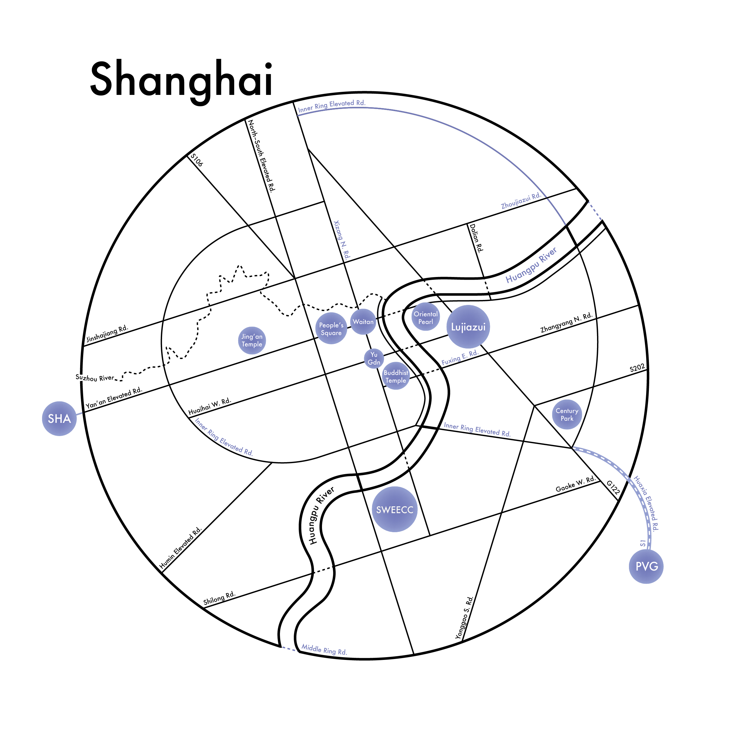
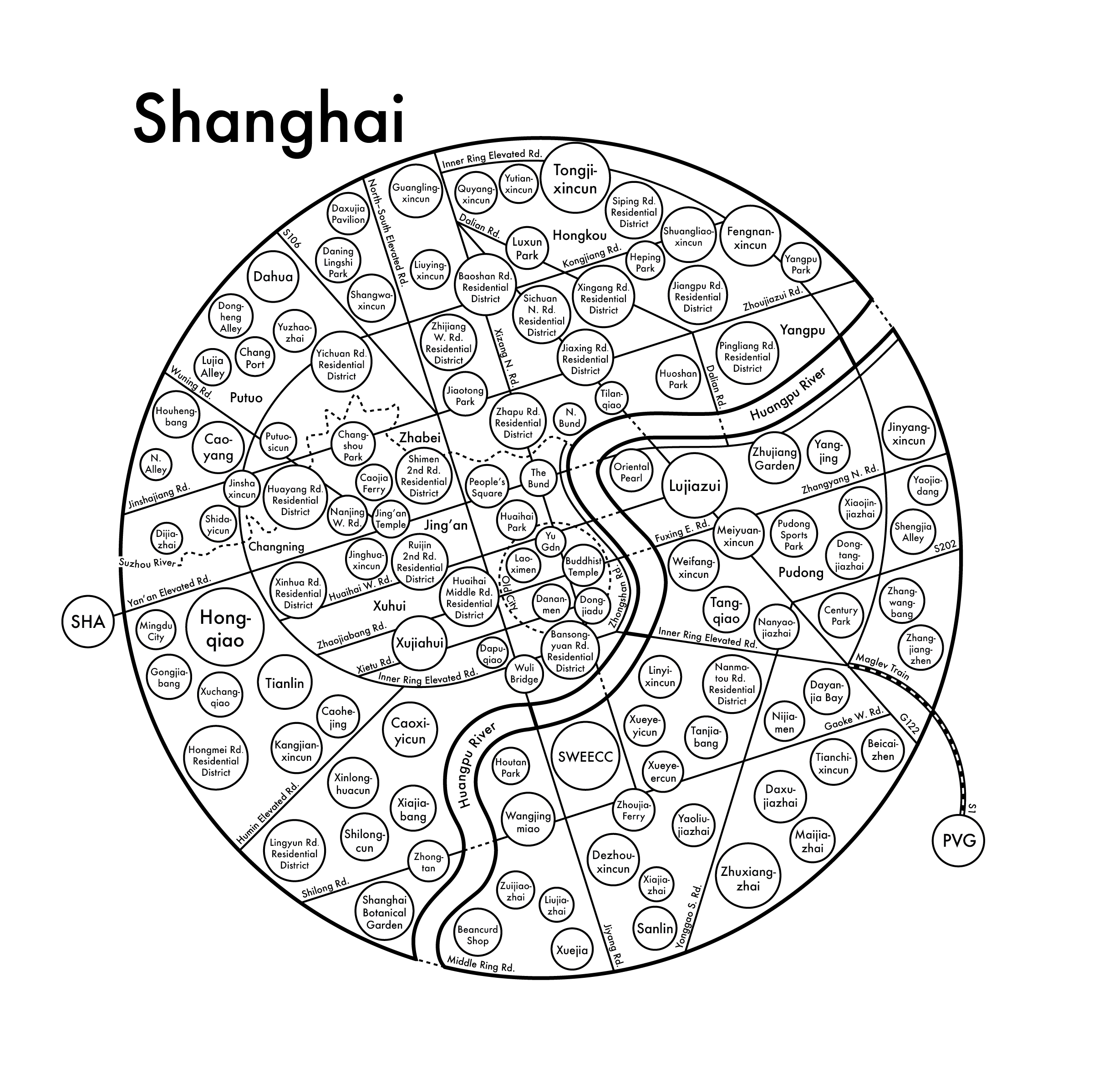
在方案三的原有基础上,我对该阶段的设计进行了完善。几乎所有的道路都注上了命名。但由于中山东一路、中山东二路和中山南路被翻译为英文后(Zhongshan E. 1st Rd., Zhongshan E. 2nd Rd., and Zhongshan S. Rd.)过长,地图上没有足够的空间可以标注全名,因此是否统一归纳为 “中山路” 以及如何标注还有待商榷。和上一稿对比可以看出由于内环高架外形的特殊性,很多部分不能被很好地识别为内环高架的一部分。因此在信息连续性损失过于严重的部分给予了重复命名。中环路为一个完整连续的环路,因此在涉及被黄浦江截断的部分用虚线进行了连结以示过江隧道。
上海虹桥国际机场和上海浦东国际机场【国际航协(International Air Transport Association/简称IATA)注册的机场三字代码分别为SHA和PVG】为两个举足轻重航空港。且连接浦东新区与浦东机场的磁悬浮列车是全球唯一一条高速商业运营的磁浮列车线路,也是目前世界范围内拥有磁浮技术的四个国家中第一个实现载客运营的线路。这些具有里程碑意义的地标均标志了上海市的繁荣与发展。【2018年05月30日】
Based on proposal #3, I labelled almost every single road. The names of Zhongshan E. 1st Rd., Zhongshan E. 2nd Rd., and Zhongshan S. Rd. are too long to fit into the spaces within the blocks, hence, whether to conclude them as “Zhongshan Rd.” or not and how to label them are still remaining questions for now. Comparing with the previous version, because of the particularity of the shape of the Inner Ring Elevated Rd., a lot of parts cannot be recognized easily. Therefore, I renamed the parts when the continuity of information is getting dramatically lost. As a complete loop formed by Middle Ring Rd., the dotted lines shows tunnels going under the Huangpu River.
Shanghai Hongqiao International Airport and Shanghai Pudong International Airport—whose International Air Transport Association (IATA) approved 3-digit code are SHA and PVG—are two major airports in the city. Meanwhile, the maglev train connecting Pudong and PVG is the only high speed commercial operating one in use all over the globe, which is also the first one that fulfilled commuting purpose among the four countries that master this technology. These milestones have been marking the prosperity and development of the city. [May 30th, 2018]
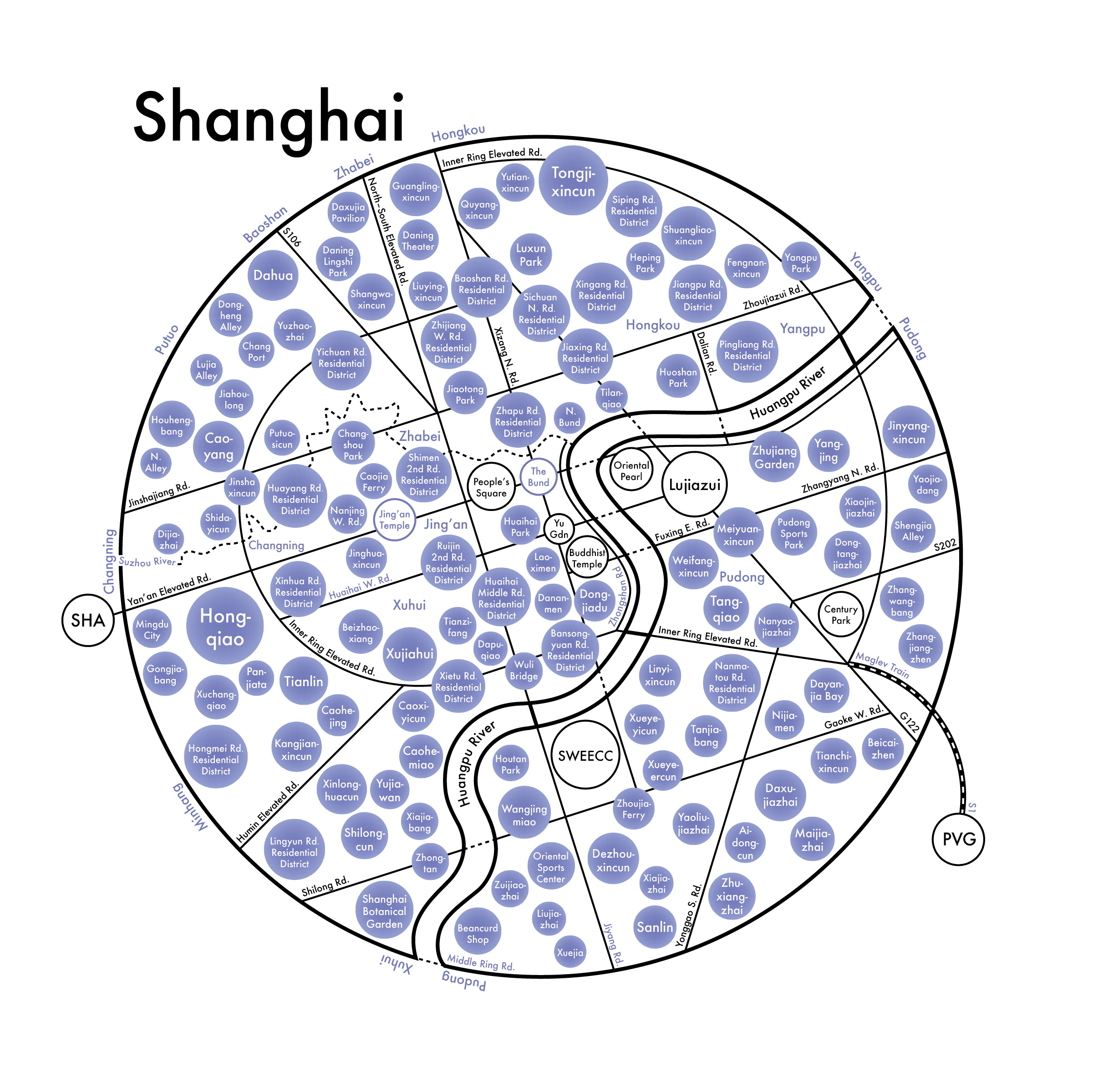
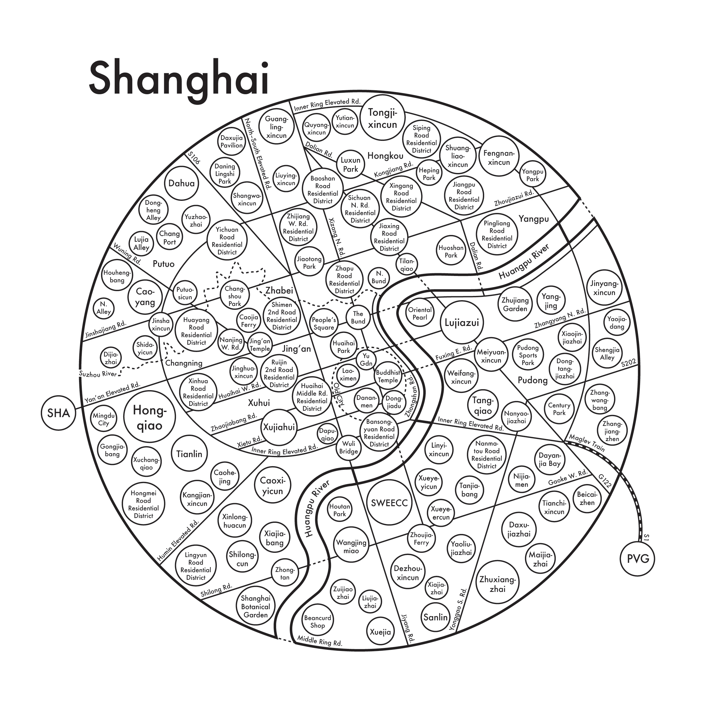
在前一版中,磁悬浮列车路线标注的是路名 “华夏高架/Huaxia Elevated Rd.” 和 “S1”。在第三阶段中,我用 “磁悬浮列车/Maglev Train” 替代了华夏高架并在版式上做了一些调整使阅读感受更流畅。在地图上标注完所有的地区后,我在地理位置上进行了一些微调并在负空间上标注了行政区的名字。【2018年07月19日】
In the previous version, the names labelled on the maglev train routes were “Huaxia Elevated Rd.” and “S1.” At stage 3, I replaced it with “Maglev Train” to make the reading flow smoother. After mapping all the neighborhoods, I made a little retouching and put the names of the districts on the negative space. [July 19th, 2018]
在和阿尔奇讨论后,我们认为当前阶段的地图设计信息量过大导致产生了阅读眩晕感。我们决定在原有基础上减去10个社区再加上5条路使效果更整体。在重新审视上海的发展史后,在上海中心城区位置我标明了老城区并做出了适当微调。此阶段基本上已经接近终点了。【2018年07月22日】
I communicated with Archie about our achievement so far and we agreed that it created the so-called “reading glare” due to the overwhelming information explosion. Therefore, we decided to remove 10 neighborhoods and add 5 more roads to get them together based on where we were currently at. After reading through the history of Shanghai’s urban development, I highlighted the “Old City” in the hub of the city and made several minor adjustments accordingly. The map is about 90% done now. [July 22nd, 2018]
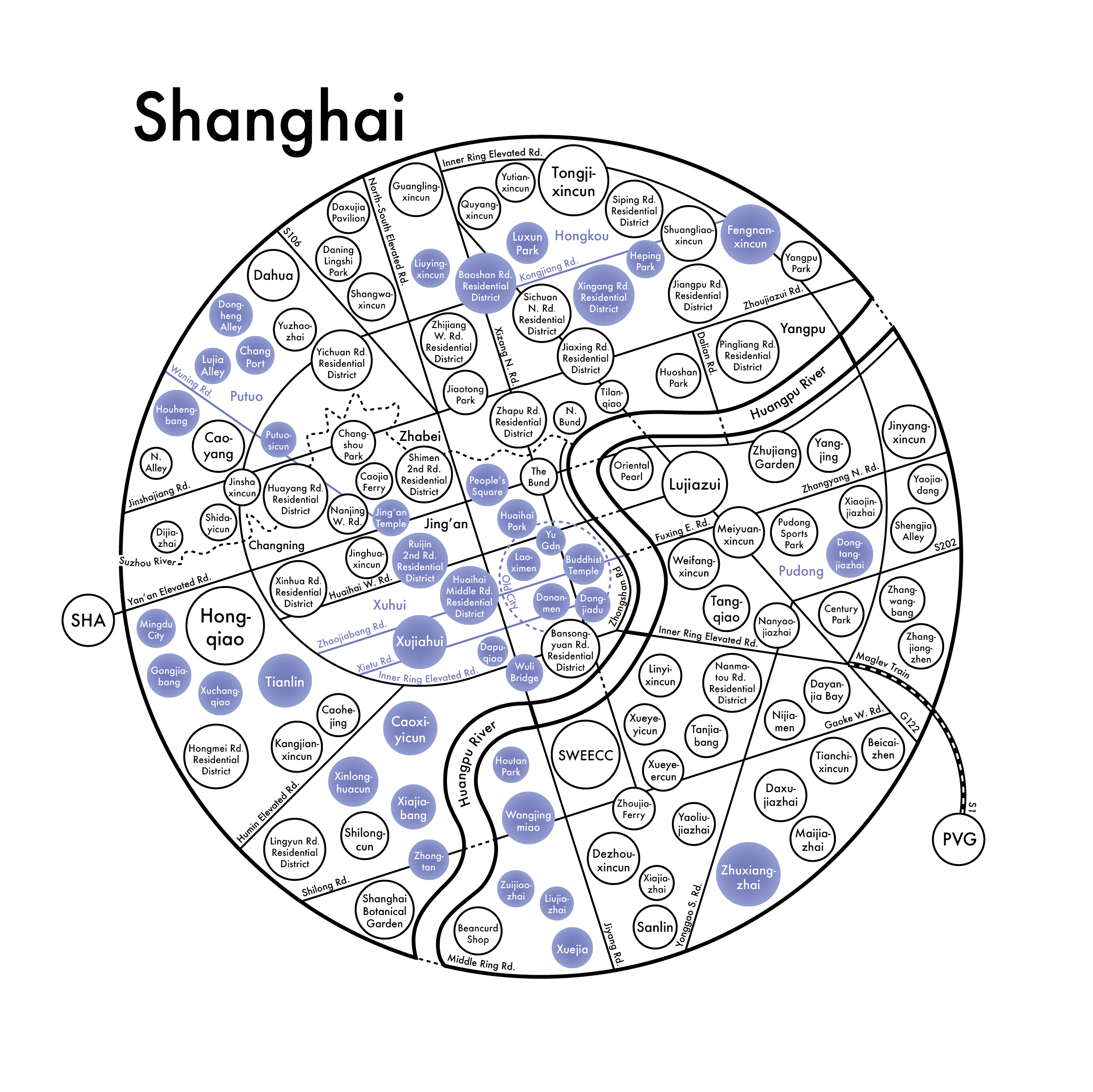
经过对上一稿的分析,地图上方的虹口区显得相对单薄负空间略大。于是我加上了大连路的北段使视觉上更加均衡。在 “老城附近中山路/Zhongshan Rd.” 的 “路/Rd” 字的缩写后忘记了加点,这一稿也一并补上了。【2018年07月24日】
I did some analysing on the last draft and I figured that Hongkou District looked a little off because of the spatious negative space. So I added the diagonal part of north Dalian Rd. At the center of the map, the period of the “Rd.” abbreviation in “Zhongshan Rd.” was missing and I fixed it as well. [July 24th, 2018]
过程动态视图/Progress Motion Graphics:
路德维希 · 密斯 · 凡 · 德 · 罗说过 “奇迹存在于细节。” 我一直认为细节在设计中举足轻重,而版式设计的精致与否很大程度上有细节决定。往往一个大小写的疏忽、一个连字符的误抑或一个视觉误差的未矫正抑都会使作品的效果大打折扣。在对所有信息拼写进行校对之后,我将部分信息的字偶间距、行间距以及版式进行了调整使阅读感受更加舒适。
Ludwig Mies van der Rohe once said that “God Is in the Details.” I believe that detail is taking a significant role in design and how professional typography could be tremendously depends on detailing. Usually a fault of capitalization, a misusing of dashes, or an optical illusion would impact the outcome. After double checking all the spellings, I did some minor kerning, leading, and typography adjusting jobs manually in order to make the reading more comfortable.


Special Thanks to
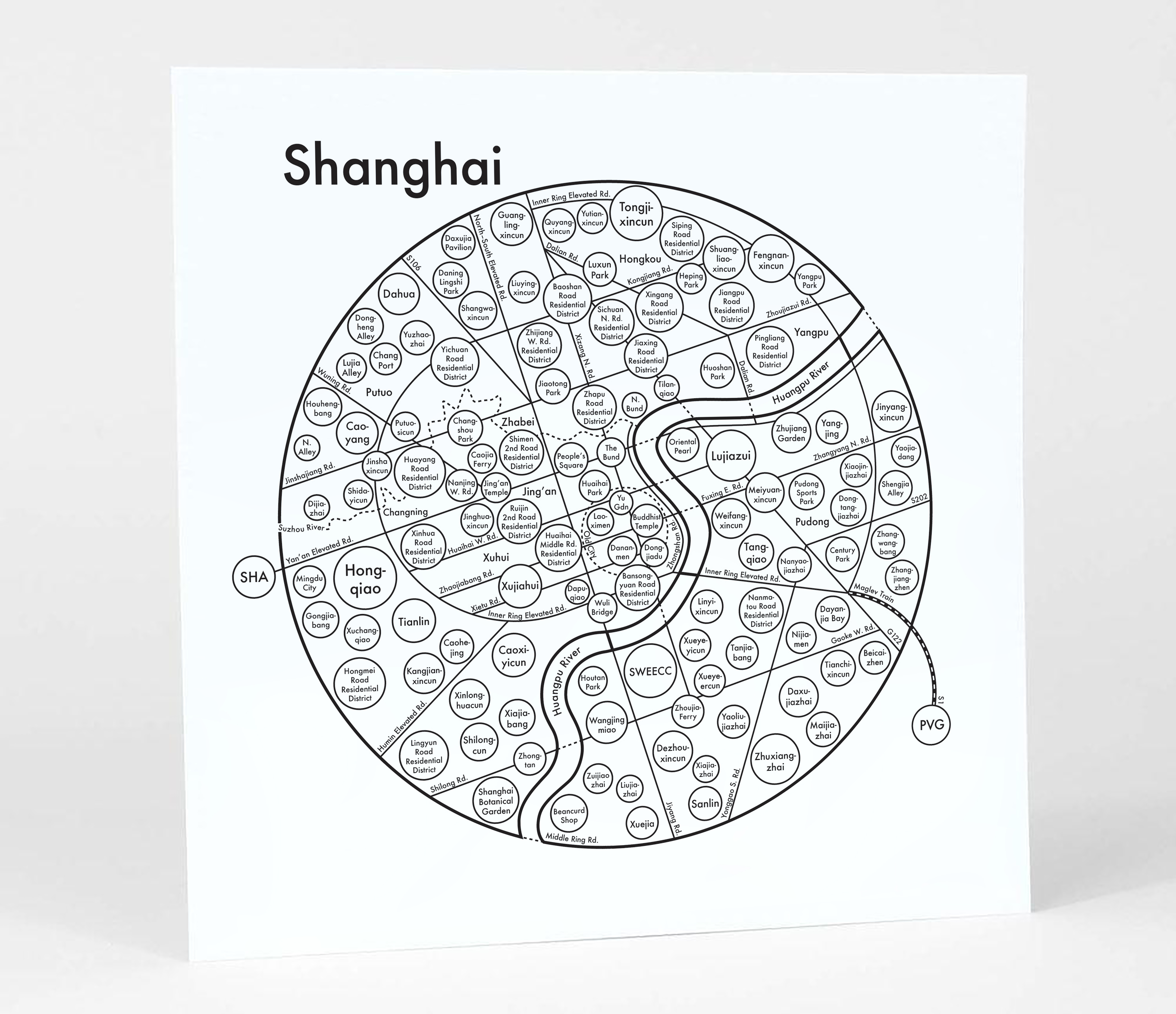
陈 翀泽 [Chongze (Oscar) Chen]这是阿尔奇凸版印刷工作室简报上关于这个项目的一篇文章。“上海思维导图” 可以在阿尔奇压印—上海地图页面购买,凸版印刷成品尺寸为20 x 20 cm。感谢您耐心阅读。希望这个项目可以对您在极简主义、地图设计和信息可视化相关项目上有所启发。
Here’s a little press of Archies’ Press’s newsletter on this project. “Shanghai Mind Map” is available at Archie’s Press Shanghai Map in letterpress in 8 x 8 inches. Thanks for reading and I hope this project could be inspiring on minimalism, mapping, and envisioning information related projects.
本人不享有上海市照片的版权。图片仅用于课程项目训练与作业,不涉及任何商用目的。如涉及版权纠纷,请联系设计师本人。相关内容会立即做删除处理。
Li Han does not own the image in the thumbnail. It is only used for educational project training and exercising instead of any commecial purpose. If there is any copyright concern, please contact the designer and the related content will be obliterated immediately.
#合作项目/collaborative project
#信息可视化/envisioning information
#思维导图设计/mind map design
#平面设计/graphic design
#凸版印刷/letterpress